|
21. A New Correct Chart of the Caribee or Windward Islands [Material cartográfico]
Moore, John Hamilton (1738-1807)
- 1784
|

|
22. A new general chart of the world
Faden William 1749-1836
- 1787
|

|
23. A new general map of the East Indies, exhibiting in the Peninsula on this side of the Ganges or Hindoostan the several partitions of the Mogul's Empire and the dominions of the English East India Company in the provinces of Bengal, Bahar, Orixa, as well as upon the coasts of Malabar and Coromandel, with the French and Dutch possessions according to the peace of 1783, and in the peninsula beyond the Ganges, the kingdoms of Assam, Cashar, Aua, Aracan, Mien, Pegu, Siam, Lao and Cambodia, &c.
Jefferys Thomas ca 1710-1771
- 1794
|

|
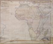
24. A new map of Africa including Arabia, the Mediterranean and part of the coast of South America compiled from the observations of the latest travellers, London, published the 1st. of Jany. 1800 by Rob. Wilkinson, Nº 58 Cornhill
Wilkinson, Robert (m. ca. 1825), cartógrafo
- 1800
|

|
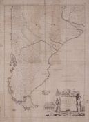
25. A New Map of the Southern Parts of America
Kitchin, Thomas,
- 1772
|

|
26. A plan and chart of Lisbon Setuval and its neighbouring country
Speer Joseph Smith fl. 1766-1796
- 1773
|

|
27. A Plan of City of New York & its Environs to Greenwich, on the Nort or Hudons River, and to Crow Point, on the East or Sound river [Material cartográfico] : shewing the several streets, Public Buildings, Docks, Fort & Battery, withh the true Form & Course of the Commanding Grounds with and without the Town : To the Honble. Thos. Gage. Esqr. Major General and Commander in Chief of his Majesty's Forces in Nort America, and Colonel of 22². Regiment of Foot : survey'd in winter 1776
Montresor, John (1736-1799)
- 1776
|

|
28. A topographical chart of the entrance of the river Tagus
Chapman William 1749-1832
- 1810
|

|
29. A topographical map of the isle of Minorca
Delarochete Louis Stanislas dªArcy 1731-1802
- 1780
|

|
30. Abbidung der besten Statt Rochelle, wie dieselbe vom König in Franckreich belagert worden. 1627
- 1627
|

|
31. Abriss des Schwedischen Lägers ben Bröhraw im Aug. Aº. 1643
Mardefeld C. fl. ca 1643-1651
- 1643
|

|
32. Abriss der Statt Bergen op Zoom Sampt dem Spãnischen Läger Im Jahr 1622
- 1630
|

|
33. Acampamento brazileiro em Curuzú, 1866 7
|

|
34. Accurata designatio celebris Freti prope Andalusiae castellum Gibraltar, inter in Europam et Africam, cum circumjacentibus Portabus, et Castellis, cura et impensis
Seutter George Matthaus 1678-1757
- 17??
|

|
35. Action near Roliça
Willermin fl. 1808
|

|
36. Adlas portatil y geographico de la Peninsula de las Españas é Islas adjacentes
Lopez de Vargas Machuca Tomás 1730-1802
- 1812
|

|
37. Adolf Stieler's Hand Atlas über alle theile der erde und über das Weltgebäude
Stieler Adolf 1775-1836
- 1886
|

|
38. Adolf Stieler's Hand Atlas über alle theile der erde und über das Weltgebäude
Stieler Adolf 1775-1836
- 1889
|

|
39. Advance of the allies upon Condeixa
Pierrepoint Major fl. ca. 1808
|

|
40. Advatici evesché de Namur
Sanson Nicolas 1600-1667
- 1750
|