Resultados

Registros 441-460 de 21.906 para a busca

Tipo de documento Material cartográfico impreso 

Registros por página:

Ordenar por

Biblioteca Nacional de España

441. A New Chart of the Coast of Scotland, from the Point of Ardnamurchan to Cape Wrath [Material cartográfico] : Including the Western Islands of Lewis and Harris, North Uist, Benbecula, South Uist, Barra, Sky, Rum, &c.

Robert Laurie and James Whittle - 1794
Biblioteca Nacional de España

442. A new chart of the Coast of Spain and Portugal [Material cartográfico] : From Cape Penas to the Streights of Gibraltar

Fleurieu, Charles-Pierre Claret de (1738-1810) - 1794
Biblioteca Nacional de España

443. A New Chart of the China Sea with its several entrances [Material cartográfico] : Drawn from a Great Number of Draughts Journals, and other Nautical Documents, Regulated by Astronomical Observations

Larkins, John Paskall - 1794
Biblioteca Nacional de España

444. A New Chart of Davis's Streights Including James Island, Waygat Island, And the Island Disko [Material cartográfico] Including James Island, Waygat Island, And the Island Disko

Steel, David - 1787
Biblioteca Nacional de España

445. A New Chart of the Downs and Margate Roads [Material cartográfico]

Moore, John Hamilton (1738-1807) - 1795
Biblioteca Nacional de Chile

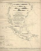
446. A new chart of the east & west coasts of South America from the River Plate to Valparaiso including the Falkland islands and plans of the principal harbours

Norie, J. W(John William), (1772-1843) - 1922
Biblioteca Nacional de España

447. A New Chart of the East Coast of England From Flamborough Head to the Entrance of Boston Deeps with the Course of The River Humber From Hull to the Sea [Material cartográfico]

Robert Laurie and James Whittle - 1794
Biblioteca Nacional de España

448. A New Chart of the East Coast of England from The Spurn Head or The Entrance of the Humber to Hasbrough Gatt and Yarmouth Roads [Material cartográfico] : Including Boston and Lynn Deeps

Sayer, Robert (1725-1794) - 1791
Biblioteca Nacional de España

449. A New Chart of the Eastern Straits or The Straits to the East of Java with the Adjacent Islands [Material cartográfico]

Robert Laurie and James Whittle - 1794
Biblioteca Nacional de España

450. A New Chart of the Entrance of the Baltic [Material cartográfico] : Comprehending The Sound, with the two Belts, and all the Danish Islands

Lous, Christian Charles - 1794
Biblioteca Nacional de España

451. A New Chart of the Gulf of St. Lawrence [Material cartográfico]

Faden, William (1749-1836) - 1790
Biblioteca Nacional de España

452. A New Chart of the Gulf or Bay of Bengal with Part of the Indian Ocean as far as the line [Material cartográfico]

Robert Laurie and James Whittle - 1794
Biblioteca Nacional de España

453. A New Chart of Harwich Harbour with the Rolling Ground, Felstow Road, Golder More's and Flats of the Naze [Material cartográfico] : most humbly Inscribed and Presented To the Honoble. Captn. James Luttrell

Burn, George - 1794
Biblioteca Nacional de España

454. A New Chart of the Indian and Pacific Oceans Between the Cape of Good Hope, New Holland, and Japan [Material cartográfico] : Comprehending New Zealand, New Caledonia, New Britain, New Ireland, New Guinea, &c: Louisiade and New Georgia : also the Pelew, New Caroline, Ladrone, and Philippine Islands, whit all those which have been discoverd in the Yeard 1788 & the tracks of the English, French, Spanish, & Dutch Discoverers

Robert Laurie and James Whittle - entre 1788 y 1794
Biblioteca Nacional de España

455. A New Chart of the Island of Guernsey with those of Sark, Herm and Jethou [Material cartográfico] : Shewing all the Rocks, Shoals and other Dangers the Channels, Soundings and Run of the Tides &c.

Dobree, Nicholas - 1794
Biblioteca Nacional de España

456. A New Chart of the Islands of Scilly [Material cartográfico] : with their Soundings Channels and Sailing Marks

Tovey, Abraham - 1794
Biblioteca Nacional de España

457. A New Chart of the Java Sea [Material cartográfico] : Within the Isles of Sunda, with Its Straits, and the Adjacent Seas

Robert Laurie and James Whittle - 1794
Biblioteca Nacional de España

458. A New Chart of the Mediterranean Sea [Material cartográfico] : Composed from the Draughts of the Pilots of Marseilles : Corrected by Astronomical Observations by Order of Mgr. Le Comte de Maurepas : To which are annexed by the Editor A Draught of the Streights Mouth including the Bays of Cadis, Gibraltar and Malaga ; also the Ports of Leghorne, Naples, Mahon, Smyrna, Salonichi, Scandaroon and Alexandria with the Course of the Nile from the last place to Cairo

Mount & Page (Londres) - entre 1700 y 1750?
Biblioteca Nacional de España

459. A New Chart of the North Coast of Java, wherein are described the Roads of Bantam and Batavia [Material cartográfico] : From the Manuscript Draught of the Dutch East India Company

Smedley, Henry. Capt. - 1790
Biblioteca Nacional de España

460. A New Chart of the North Coast of Scotland From Cape Wrath to Duncansby Head, whit Pentland Firth and the Orkney Islands [Material cartográfico] : From Cape Wrath to Duncansby Head, with Pentland Firth and the Orkney Islands

Robert Laurie and James Whittle - 1794