Resultados

Registros 2.781-2.800 de 6.480 para la búsqueda

Tipo de documento Material cartográfico impreso Y Institución Biblioteca Nacional de Chile 

Registros por página:

Ordenar por:

Biblioteca Nacional de Chile

2781. Isla Wickham

Instituto Geográfico Militar (Chile)
Biblioteca Nacional de Chile

2782. Itahue

Instituto Geográfico Militar (Chile)
Biblioteca Nacional de Chile

2783. Itahue Departamentos de Talca i Lontué

Chile. Ejército. Estado Mayor General.. Departamento de Levantamiento - 1916.
Biblioteca Nacional de Chile

2784. Italia mapa para seguir las operaciones bélicas con el trazado de los caminos

Sociedad Nacional de Publicidad (Chile) - 1944.
Biblioteca Nacional de Chile

2785. Itinerario del Dr. Rudolfo Philippi por el desierto de Atacama desde Taltal hasta San Pedro de Atacama y desde ese pueblo hasta Copiapó (aproximadamente 273 leguas) 11 de enero a 25 de febrero de 1854

Biblioteca Nacional de Chile

2786. Itraque

Instituto Geográfico Militar (Chile)
Biblioteca Nacional de Chile

2787. Jahuel

Instituto Geográfico Militar (Chile)
Biblioteca Nacional de Chile

2788. Junquillar Constitución Departamento de Constitucióm

Instituto Geográfico Militar (Chile) - 1934.
Biblioteca Nacional de Chile

2789. La Junta

Instituto Geográfico Militar (Chile)
Biblioteca Nacional de Chile

2790. La Junta

Instituto Geográfico Militar (Chile)
Biblioteca Nacional de Chile

2791. Junta de Chingoles

Instituto Geográfico Militar (Chile)
Biblioteca Nacional de Chile

2792. Junta de Chingoles

Instituto Geográfico Militar (Chile)
Biblioteca Nacional de Chile

2793. Junta de Chingoles

Instituto Geográfico Militar (Chile)
Biblioteca Nacional de Chile

2794. Juan Soldado

Instituto Geográfico Militar (Chile)
Biblioteca Nacional de Chile

2795. Kaart over den Syd Østlige Deel at Øster_Søen

Klint, Gustaf de J. G. Blankensteiners Forlag,
Biblioteca Nacional de Chile

2796. Karta öfver Kattegat och Bohus Bugten med en del af Skagerrak

Klint, Gustaf af, - 1806.
Biblioteca Nacional de Chile

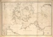
2797. Karta öfver SydWestre delen af Öster Sjön med Sundet och Belterne samt en del af Hamburgska Bugten

Klint, Gustaf af, - 1808.
Biblioteca Nacional de Chile

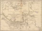
2798. Karte der Magellanischen Strasse

- 1769.
Biblioteca Nacional de Chile

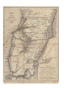
2799. Karte der Provinz Valdivia Nach den statistischen Daten die sich bis jetzt haben sammeln lassen, und theilweisen Aufnahmen construirtn

Philippi Krumwide, Bernardo E., - 1846.
Biblioteca Nacional de Chile

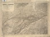
2800. Karte der Schweiz in IV blattern nach dem topographischen atlasse des eidgenössischen generalstabes

Dufour, Guillaume Henri (1787-1875) - 1867-1873