Resultados

Registros 81-100 de 13.625 para la búsqueda

Autor X*** 

Registros por página:

Ordenar por:

Biblioteca Nacional de España

81. A Plain Chart of the Seychelles, Praslin & other adjacent Islands [Material cartográfico] : Situated from Latt. 4°.50'.15'S with the Soundings and Tracks of the Frigates La Flute, La Digue, and the Schooner Curieuse partly geometrically Surveyed and from Observations made in November an December 1768

Gilbert, William (s. XVIII) - entre 1768 y 1790
Biblioteca Nacional de España

82. A Plan of the Bay and Harbour of Subec near Manilla on the Island Luconia One of the Philippine Islands [Material cartográfico] : on the Island Luconia One of the Philippine Islands from the latest Observations

Gilbert, William (s. XVIII) - 1790
Biblioteca Nacional de España

83. A Plan of the Bay on the South West side of Pulo Auore [Material cartográfico]

Nicholson, William (s. XVIII) - entre 1763 y 1794
Biblioteca Nacional de España

84. A Plan of the Bay on the South West Side of Pulo Timon [Material cartográfico]

Nicholson, William (s. XVIII) - entre 1763 y 1794
Biblioteca Nacional de España

85. A Plan of Bombay Harbour, on the Coast of Malabar ... [Material cartográfico]

Nicholson, William (s. XVIII) - 1794
Biblioteca Nacional de España

86. A Plan of the Cities of London and Westminster, the Bourough of Soutwark, and the Contiguous Building [Material cartográfico] : With All The New Roads That Have Been Made on Account of Westminster Bridge and the New Buldings and Alterations to the Present Year MDCCLV

Benning, Robert (s. XVIII) - 1755
Biblioteca Nacional de España

87. A Plan of Manchester and Salford [Material cartográfico]

Green, William (s. XVIII) - entre 1787 y 1794
Biblioteca Nacional de España

88. A Plan of the Surprise of Stoney Point, by a Detachment of the American Army, commanded by Brigr. Genl. Wayne, on the 15th. July, 1779 [Material cartográfico] : Also of the Works erected on Verplanks Point, for the Defence of Kings Ferry, by the British Forces in July 1779, from the Surveys of Wm. Simpson Lt. 17th. Rt. and D. Campbell Lt. 42d. Rt.

Simpson, William (s. XVIII) - entre 1779 y 1784
Biblioteca Nacional de España

89. A Plan of the Town of Northamton Survey'd in MDCCXLVI [Material cartográfico]

Noble, John (s. XVIII) - entre 1746 y 1747
Biblioteca Nacional de España

90. A pluma y a pelo [Manuscrito] : juguete cómico, en un acto, original y en verso. Emp.: ¿Preparasteis todo? (h. 3)... Fin.: si tocáis palmas (h. 21v)

A.M.V. - entre 1851 y 1900?
Biblioteca Nacional de Brasil

91. A praia de Itapuca (Rio de Janeiro)

Briscoe, H., Séc. XIX - 1872
Biblioteca Nacional de Brasil

92. A preta do acarajé

Caymmi, Dorival, 1914-2008 - 1939
Biblioteca Nacional de España

93. A PRINCESS OF STOLBERG.

Giardoni, Alessio - 1773
Biblioteca Nacional de Chile

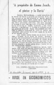
94. "A propósito de Emma Jauch, el pintor y la lluvia"

Bizama, Ximena
Biblioteca Nacional de España

95. A puerta cerrada, el diablo se vuelve [Manuscrito] : juguete cómico en un acto y en prosa. Emp.: ¡Clemente! ¡eh, Clementillo! soy yo (h. 1v)… Fin.: Señores ¿ustedes gustan…? (h. 14v)

Martínez, C. - entre 1851 y 1900?
Biblioteca Nacional de España

96. A Reducced Chart of Bombay Harbour [Material cartográfico] : to ferve as on Index...

Nicholson, William (s. XVIII) - 1764?
Biblioteca Nacional de España

97. A la Ser[enisima] Señora princesa de Asturias ... Elógia en sus célebres dias, y reales besa manos en el siguiente metro

Vigil, José - 1787
Biblioteca Nacional de España

98. A Sketch of the Worcester's Track over the Precilla Bank. [Material cartográfico]

Gilbert, William (s. XVIII) - 1792
Link

99. A tierras del moro [Grabación sonora] : seguidillas ; Entre el gentío ; Porque lo manda el destino : fandangos

Valerio, Xandro (1896-1966) - 1951
Biblioteca Nacional de España

100. A Topographical map of the County of Berks [Material cartográfico] = Carte Topographique de le Comté de Berks

Benning, Robert (s. XVIII) - 1761