Resultados

Registros 541-560 de 21.906 para a busca

Tipo de documento Material cartográfico impreso 

Registros por página:

Ordenar por

Biblioteca Nacional de España

541. A New Map of South America [Material cartográfico]

Harrison and Co. - 1785
Biblioteca Nacional de España

542. A New Map of South America [Material cartográfico] : drawn from the latest Discoveries

Puke, J. - 1794
Biblioteca Nacional de Argentina

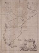
543. A New Map of the Southern Parts of America

Kitchin, Thomas, - 1772
Biblioteca Nacional de España

544. A New Map of Spain and Portugal [Material cartográfico] : Divided into their Respective Kingdoms and Provinces from the Latest Authorities

Cary, John (1755-1835) - 1801
Biblioteca Nacional de España

545. A new map of Spain and Portugal exhibiting the Chains of Mountains with their Passes the principal and cross roads, with other details requisite for the intelligence of military operations [Material cartográfico]

Nantiat, Jasper - 1810
Biblioteca Nacional de España

546. A New Map of Turkey in Asia [Material cartográfico]

Anville, Jean-Baptiste Bourguignon d' (1697-1782) - 1794
Biblioteca Nacional de España

547. A New Map of Turkey in Europe Divided into all its Provinces, with the Adjacent Countries in Europe and Asia [Material cartográfico] : Drawn Chiefly from the Maps Published by the Imperial Academy of St. Petersburg

Vivares, Francis, Junr. - 1794
Biblioteca Nacional de España

548. A New Map of the United Provinces. Comprehending Holland, Zealand, Utrecht, Gelders, Over Yssel Friesland and Groningen with the Lands of Drent, Dutch Flanders & Dutch Brabant &c &c [Material cartográfico]

Cary, John (1755-1835) - 1794
Biblioteca Nacional de España

549. A New Map of Virginia, Maryland, Pensilvania, New Jersey, Part of New York, And Carolina [Material cartográfico]

Thornton, John (1641-1708) - 1740?
Biblioteca Nacional de España

550. A New Map of the West Indian Islands, as they are Possessed by the European Powers [Material cartográfico] : Drawn from the most Recent Anthorities

Robert Laurie and James Whittle - 1795
Biblioteca Nacional de España

551. A New Map of the Western Parts of Virginia, Pennsylvania, Maryland and North Carolina [Material cartográfico] : Comprehending the River Ohio, and all the Rivers, wich fall into it, Part of the River Mississippi, the Whole of the Illinois River, Lake Erie, Part of the Lakes Huron, Michigan &c., And all the Country bordering on these Lakes and Rivers

Hutchins, Thomas (1730-1789) - 1778
Biblioteca Nacional de España

552. A new map of the world with the latest Discoveries [Material cartográfico]

Dunn, Samuel (m. 1794) - 1794
Biblioteca Nacional de España

553. A New Map or Chart in Mercators Projection of the Western or Atlantic Ocean, with part of Europe, Africa and America [Material cartográfico]

Gregory, Henry - 1764
Biblioteca Nacional de España

554. A New Mapp of the kingdom of England shewin its antient and present government being dividef as in the Saxon Heptarchy also in to dioceses judges circuitts and countues describeing all the citys ... [Material cartográfico]

Harris, John (fl. 1685-1720) - 1735?
Biblioteca Nacional de España

555. A New Mercators Chart of the Coast of Ireland from Drogheda to the Skerries [Material cartográfico]

- entre 1750 y 1800?
Biblioteca Nacional de España

556. A New Mercators Chart of the Coast of Ireland from Kerry Head to Kilmury [Material cartográfico]

Cooke, John - 1790
Biblioteca Nacional de España

557. A New Mercators Chart of the Coast of Ireland from Kilmury Head to Drogheda [Material cartográfico]

- entre 1750 y 1800?
Biblioteca Nacional de España

558. A New Mercators Chart of the Irish Coast from Balliconel to Slyne Head [Material cartográfico]

Cooke, John - 1790
Biblioteca Nacional de España

559. A New Mercators Chart of the Irish Coast from the Skerries to Balliconel [Material cartográfico]

Steel, David - 1790
Biblioteca Nacional de España

560. A New Mercators Chart of the Irish Coast from Sline Head to Kerry Head [Material cartográfico]

Steel, David - 1790