Resultados

Registros 1-20 de 53 para la búsqueda

Autor Kitchin, Thomas 

Registros por página:

Ordenar por:

Biblioteca Nacional de España

1. A chart of the Atlantic Ocean, Its Islands and the adjacent Continents [Material cartográfico] : In which the British Dominions in Europe and America, the West Indies and on the African Coast are seen at one view: The Distances and Superficial Dimensions retaining every where very nearly, their just Proportions and the Rumbs exactly delineated, shew the Nautical Courses from any Port to the Entrance of the British Channel or between any two Ports proposed

Kitchin, Thomas (1718-1784) - entre 1745 y 1767?
Biblioteca Nacional de España

2. A Map of the British and French Dominions in North America with the Road, Distances, Limits and Extent of the Settlements, Humbly Inscribed to the Rights Honourable the East of Halifax, And the other Rights Honourable The Lords Commissioners for the Trade & Plantations [Material cartográfico]

Kitchin, Thomas (1718-1784) - 1755
Biblioteca Nacional de España

3. A Map of the British Colonies in North America [Material cartográfico] : with the Roads, Distances, Limits, and Extent of the Settlements, Humbly Inscribed to the Right Honourable the East of Halifax, And the other Right Honourable, The Lords Commissioners for Trade & Plantations

Kitchin, Thomas (1718-1784) - 1755
Biblioteca Nacional de España

4. A Map of the County of Kent [Material cartográfico] : Taken from an Actual Survey as an Index to the Large One

Kitchin, Thomas (1718-1784) - 1769?
Biblioteca Nacional de España

5. A Map of South America [Material cartográfico] : According to the best Autorithies

Kitchin, Thomas (1718-1784) - 1788?
Biblioteca Nacional de España

6. A New and Accurate Map of the British Dominions in America, according to the Treaty of 1763 [Material cartográfico] : Divided into the several Provinces and Jurisdictions

Kitchin, Thomas (1718-1784) - 1763
Biblioteca Nacional de España

7. A New and Accurate Map Warwickshire Draw from the best Surveys and Intelligence [Material cartográfico] : Divided into its Hundreds Shewing the several Roads & true Measured Distances between Town & Town Also the Rectories and Vicarages the Parks & Seats of the Nobility and Gentry, with other useful Particulars

Kitchin, Thomas (1718-1784) - 1770?
Biblioteca Nacional de España

8. A new geographical, historical, and commercial grammar and present state of the several kingdoms of the world : containing, I. The figures, motions, and distances of the planets, according to the Newtonian system, and the latest observations ...XII. The longitude, latitude, bearings and distances of principal places from London : to which are added, I. A geographical index, with the names of places alphabetically arranged. II. A table of the coins of all nations ... remarkable events from the creation to the present time

Guthrie, William - 1792
Biblioteca Nacional de España

9. A New Geographical, Historical, and Commercial Grammar; and Present State of the several Kingdoms of the World ... [Texto impreso]

Guthrie, William - 1777
Biblioteca Nacional de España

10. A New Improved Map of Cornwall from the Best Surveys & Intellingences Divided into its Hundreds [Material cartográfico] : Shewing the several Roads and true Measured Distances between Town & Town Also the Rectories and Vicarages the Parks & Seats of the Nobility & Gentry with other useful Particulars Regulated By Astronomical Observations

Kitchin, Thomas (1718-1784) - 1775?
Biblioteca Nacional de España

11. A New Improved Map of Hampshire from the best Surveys & Intelligences Divided into its Hundreds [Material cartográfico] : Shewing the several Roads and true Measured Distances between Town and Town Also the Rectories & Vicarages the Parks and Seats of the Nobility & Gentry with other useful Particulars

Kitchin, Thomas (1718-1784) - entre 1775 y 1795?
Biblioteca Nacional de España

12. A New Improved Map of Hartfordshire from the Best Surveys & Intelligence [Material cartográfico] : Divided into its Hundreds : Shewing the Several Roads &c true Measured Distances between Town & Town Also the Rectories & Vicarages...

Kitchin, Thomas (1718-1784) - entre 1749 y 1775?
Biblioteca Nacional de España

13. A New Improved Map of Northumberland from the Best Surveys & Intelligences [Material cartográfico] : Divided into its Wards. Shewing the several Roads and true Measured Distances between Town & Town, Also the Rectories and Vicarages, the Parks & Seats of the Nobility & Gentry, with other useful Particulars

Kitchin, Thomas (1718-1784) - entre 1775 y 1795?
Biblioteca Nacional de España

14. A New Improved Map of Oxfordshire from the Best Surveys and Intelligences, Divided into its Hundreds [Material cartográfico] : Shewing the several Roads and true Measured Distances between Town and Town; Also the Rectories and Vicarages, the Parks and Seats of The Nobility & Gentry, with other useful Particulars

Kitchin, Thomas (1718-1784) - entre 1775 y 1795
Biblioteca Nacional de España

15. A New Map of England & Wales [Material cartográfico] : Drawn from several Surveys &c on the New Projection

Kitchin, Thomas (1718-1784) - 1794
Biblioteca Nacional de España

16. A new map of Ireland divides into provinces, countis [Material cartográfico]

Kitchin, Thomas (1718-1784) - 1777
Biblioteca Nacional de España

17. A New Map of the Island of Jamaica [Material cartográfico] : Divided into its Parishes : Including the South End of Cuba and the West End of Hispaniola with the Trade Winds &c.

Kitchin, Thomas (1718-1784) - 1763?
Biblioteca Nacional de España

18. A New Map of the Island of Tobago [Material cartográfico] : shewing all the Rocks Shoals and Soundings

Kitchin, Thomas (1718-1784) - 1779
Biblioteca Nacional de Argentina

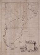
19. A New Map of the Southern Parts of America

Kitchin, Thomas, - 1772
Biblioteca Nacional de España

20. An Accurate Map of Cardigan Shire [Material cartográfico] : Draw from an Actual Survey with various Improvements. Illustrated with Historical Extracts relative to its Natural Produce, Trade, Manufactures, Air, Soil, &c.

Kitchin, Thomas (1718-1784) - entre 1775 y 1795?