Resultados

Registros 3.701-3.720 de 677.631 para la búsqueda

Registros por página:

Ordenar por:

Biblioteca Nacional de España

3701. A Chart of the Coast of New York to North Carolina [Material cartográfico]

- entre 1750 y 1800?
Biblioteca Nacional de España

3702. A Chart of the Coast of Pegu with the Adjacent Coast of Arakan and Tanasserim [Material cartográfico]

Ritchie, Capt. John - 1794
Biblioteca Nacional de Chile

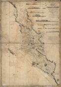
3703. A Chart of the Coast of Peru from Point Pasamayo to Point Negra including the Road of Callao taken from the Spanish Surveys published in the Hydrographical office, Madrid in 1811

Biblioteca Nacional de España

3704. A Chart of the Coast of Spain and Portugal with the Balearic Islands and part of the coast of Barbary [Material cartográfico]

La Rochette, Louis Stanislas d'Arcy de (1731-1802) - 1779
Biblioteca Nacional de España

3705. A Chart of the Coast of Wales in St. George's Channel [Material cartográfico]

Morris, Lewis - entre 1737 y 1748
Biblioteca Nacional de España

3706. A chart of the coasts of England, France & Spain [Material cartográfico] : from the Isle of Wight to Cape Finisterre in Spain

Steel, David - 1788
Biblioteca Nacional de España

3707. A Chart of the coasts of Spain and Portugal with the Balearic Islands and part of the coast of Barbary [Material cartográfico]

La Rochette, Louis Stanislas d'Arcy de (1731-1802) - 1780
Biblioteca Nacional de Portugal

3708. A chart of the coasts of Spain and Portugal with the Balearie Islands and part of the coast of Barbary

Delarochete Louis Stanislas dªArcy 1731-1802 - 1779
Biblioteca Nacional de España

3709. A Chart of the China Seas [Material cartográfico] : Containing the Coast of Tsiompa, Cochin China, Tonquin, Part of ghe Coast of China, the Philippine Islands, &c.

Dalrymple, Alexander (1737-1808) - 1791
Biblioteca Nacional de Portugal

3710. A chart of the China sea

Dalrymple Alexander 1737-1808 - 1780
Biblioteca Nacional de España

3711. A Chart of the China Sea [Material cartográfico] : Inscribed to Monsr. D'Aprés de Mannevillette the ingenious Author of the Neptune Oriental : As a Trubute due to his Labours for the benefit of Navigation and in acknowledgement of his many signal Favours to ADalrymple

Henry, B. - 1771
Biblioteca Nacional de España

3712. A Chart of the China Sea and Philippine Islands with the Archipielagos of Felicia and Soloo [Material cartográfico] : Shewing the whole Tract comprized, between Canton and Balambangan, with the Soundings, Shoals, Rocks &ca.

Murillo Velarde, Pedro (1696-1753) - 1794
Biblioteca Nacional de España

3713. A Chart of the China Sea from the Island of Sanciam to Pedrabranca [Material cartográfico] : with the Course of the River Tigris from Canton to Macao

Sayer, Robert (1725-1794) - entre 1750 y 1800?
Biblioteca Nacional de España

3714. A Chart of Delaware Bay and River [Material cartográfico] : Containig A full and exact Description of the Shores, Creks, Harbours, Soundings, Shoals, Sands, and Bearings of the most considerable Land Marks, &c. &c.

Fisher, Joshua (1707-1783) - 1794
Biblioteca Nacional de España

3715. A Chart of Delaware Bay and River [Material cartográfico] : Containing a full and exact description of the Shores, Creeks, Harbours, Soundings, Shoals, Sands and Bearings of the most considerable Land Marks, from the Capes to Philadelphia

Haydon, William - 1776?
Biblioteca Nacional de España

3716. A Chart of Delaware Bay and River [Material cartográfico] : Containing a full & exact description of the Shores, Creeks, Harbours, Soundings, Shoals, Sands and Bearings of the most considerable Land Marks, from the Capes to Philadelphia

Fisher, Joshua (1707-1783) - 1776
Biblioteca Nacional de España

3717. A Chart of the Downs [Material cartográfico] : from the latest Observations, of the most eminent Pilots

Arnold, Stuart Amos - 1783
Biblioteca Nacional de España

3718. A Chart of the Downs with the Flats of the North and South Forelands [Material cartográfico]

Ross, Joseph - 1795
Biblioteca Nacional de España

3719. A Chart of East and West Florida, from the River St. John to Mississipi River [Material cartográfico]

Steel, David - 1792
Biblioteca Nacional de España

3720. A Chart of the East Coast of England from Lowestoff to Scarborough [Material cartográfico]

Woodman, T. I. - 1782?