Resultados

Registros 381-400 de 21.906 para a busca

Tipo de documento Material cartográfico impreso 

Registros por página:

Ordenar por

Biblioteca Nacional de España

381. A New and Correct Chart of the Straits of Malacca [Material cartográfico] : Whith the Coast of Malacca & part of the Island of Sumatra ...

Mount & Page (Londres) - 1750?
Biblioteca Nacional de España

382. A New and Correct Chart of the West and part of the North West Coast of Ireland [Material cartográfico] : From Sligo Bay to the River Shannon

Hamilton Moore, John - 1791
Biblioteca Nacional de España

383. A New and Correct Chart of the West Coast and Islands of Scotland [Material cartográfico] : Including the Navigation from the Mull of Cantire to Cape Wrath

Hamilton Moore, John - 1790
Biblioteca Nacional de España

384. A New and Correct Chart of the West India Islands [Material cartográfico] : including the Gulf and Windward Passage

Moore, John Hamilton (1738-1807) - 1784
Biblioteca Nacional de España

385. A New and Correct Chart of the West India Islands including the Gulf and Windward Passage [Material cartográfico]

Moore, John Hamilton (1738-1807) - 1791
Biblioteca Nacional de España

386. A New and Correct Chart, of the Bay of Dublin and Coast of Ireland from Wicklow to Balbriggen [Material cartográfico]

Larken - entre 1750 y 1800
Biblioteca Nacional de España

387. A New and Correct Chart, Shewing the Sands, Shoals, Mud Banks, Depth of Water & Anchorage [Material cartográfico] : With the Going over the Braces, from P. Palmiras to Calcutta in the River Hughley in the Bay of Bengall

Warren, Thomas Gregory - entre 1750 y 1800
Biblioteca Nacional de Portugal

388. A new and correct map of the british Colonies in North America comprehending Eastern Canada with the province of Quebec, New Brunswick, Nova Scotia, and the Government of Newfoundland with the adjacent states of New England, Vermont, New York, Pennsylvania and New Jersey

- 1794
Biblioteca Nacional de España

389. A New and Correct Map of the County of Northumberland [Material cartográfico]

Armstrong, Andrew (fl. 1768-1781) - 1787
Biblioteca Nacional de España

390. A new and correct Map of London, Westminster and Southwark : exhibiting the various improvements to the year 1817 [Material cartográfico]

- 1817
Biblioteca Nacional de España

391. A New and Correct Map of the Province of Quebec with the Adjacent States and Provinces from the French Surveys [Material cartográfico] : Connected with those made by Captain Carver and other Officers, in his Majesty's Service

Carver, Jonathan - 1788
Biblioteca Nacional de España

392. A New and correct Map of the United States of North America Layd down from the Latest Observations and best Authorities agreeable to the Peace of 1783 [Material cartográfico]

Buell, Abel (1742-1822) - 1783?
Biblioteca Nacional de España

393. A New and Correct Mapp of St. Georges Chanell and Chapps of the English Chanel with the Sounding to the Westward [Material cartográfico]

Thornton, Samuel - entre 1750 y 1800?
Biblioteca Nacional de Argentina

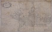
394. A New and Correct mapp of the World According to Mr. Edward Wright Commonly called Mercator's Projection with a weiw of the wind and variation

Thornton, John, - 1743
Biblioteca Nacional de España

395. A new and Exact Chart Containing the Sea Coasts of Europe, Africa & America From ye. Isles of Fero to Cape Bona Esperanca and From Hudsons Bay to the Straits of Magellane [Material cartográfico]

Mount & Page (Londres) - entre 1700 y 1750?
Biblioteca Nacional de España

396. A New and Exact Draught of the Chanell of Bristoll [Material cartográfico] : from Hartland Poynt to the River Avon & from Caldy Isle to Red Cliff

Williams, Capt. John - 1760?
Biblioteca Nacional de España

397. A New and Exact Hydrographical Survey of the River Shannon [Material cartográfico] : from Limerick to the Sea, with all the Banks, Shoals, Rocks, Channels, Soundings, Anchoring Places, &c.

Robert Laurie and James Whittle - 1794
Biblioteca Nacional de España

398. A New and Exact Map of the Island of Antigua in America [Material cartográfico] : According to an Actual and Accurate Survey made in the Years 1746, 1747 & 1748. Describing the limits & Boundaries of the Several Parishes, with the Churches, also the Divisions, with their respective Boundaries, high Roads, Jury Paths, the Situation of every Gentleman's Plantation Mills, Works and Houses, with the Harbours, Bays, Creeks, Islands, Rocks, Shoals and Soundings that surround the whole

Baker, Robert (topógrafo) - entre 1748 y 1749
Biblioteca Nacional de España

399. A New and Exact Map of the Island of St. Christopher in America According to an Actual and Accurate Survey made in the Year 1753 [Material cartográfico] : Describing the several Parishes, with their respective Limits, Contents, & Churches, also the high ways, the Situation of every Gentleman's Plantation, Mills, and Houses, with the Rivers, and Gutts. Likewise the Bays, Roads, Rocks, Shoals and Soundings that Surround the Whole

Baker, Samuel - 1780?
Biblioteca Nacional de España

400. A New and Exact Map of the Island of St. Christopher in America According to an Actual and Accurate Survey made in the Year 1753 [Material cartográfico] : Describing the several Parishes, with their respective Limits, Contents, & Churches, also the high ways, the Situation of every Gentleman's Plantation, Mills, and Houses, with the Rivers, and Gutts. Likewise the Bays, Roads, Rocks, Shoals and Soundings that Surround the Whole

Baker, Samuel - 1753