|
401. A new and exact map of Spain & Portugal
Jefferys Thomas ca 1710-1771
- 1717
|

|
402. A New and Exact Map of Spain & Portugal [Material cartográfico] : Corrected According of the Best Observations
Willdey, George
- 1717
|

|
403. A New and Exact Map of Spain & Portugal [Material cartográfico] : Divided into its Kingdoms and Principalities &c with ye. Principal Roads and considerable Improvements, the whole rectifyd according to ye. Newest Observations
Moll, Herman (m. 1732)
- 1711
|

|
404. A new and general map of the middle dominions belonging to the United States of America, viz. Virginia, Maryland, the Delaware counties, Pennsylvania, New Jersey & C with the addition of New York, & of the greatest part of New England & C as also of the bordering parts of the British possessions in Canada
- 1794
|

|
405. A New and General Map of the Middle Dominions Belonging to the United States of America, viz. Virginia, Maryland, the Delaware Counties, Pennsylvania, New Jersey &c. [Material cartográfico] : with the Addition of New York, & of the Greatest Part of New England &c. as also of the Bordering Parts of the British Possessions in Canada
Robert Laurie and James Whittle
- 1794
|

|
406. A new and general map of the southern dominions belonging to the United States of America, viz. North Carolina, South Carolina, and Georgia with the bordering Indian countries, and the Spanish possessions of Louisiana and Florida
- 1794
|

|
407. A New and General Map of the Southern Dominions Belonging to The United States of America, viz North Carolina, South Carolina, and Georgia [Material cartográfico] : with the Bordering Indian Countries, and The Spanish Possessions of Louisiana and Florida
Robert Laurie and James Whittle
- 1794
|

|
408. A New and Improved Chart of the Bristol Channel [Material cartográfico] : with the Plans of Tenby and Caldey Roads, Padstow Harbour &c.
Robert Laurie and James Whittle
- 1794
|

|
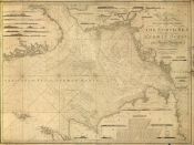
409. A New and Improved Chart of the Gulf and River of St. Lawrence [Material cartográfico]
Heather, William (fl. 1790-1812)
- 1795
|

|
410. A new and improved chart of the Mediterranean Sea including the coast of Spain and Portugal
|

|
411. A new and improved chart of the North Sea or the German Ocean constructed Mercator's projection
Heather, William
|

|
412. A New and Improved Chart of the Northern Part, of the Bay of Bengal [Material cartográfico]
Plaisted, Bartholomew (m. 1767)
- 1791
|

|
413. A New and Improved Chart of the West India or Carribbee [sic] Islands [Material cartográfico]
Heather, William (fl. 1790-1812)
- 1795
|

|
414. A new and improved Map of Europe from the best Foreing surveys Ec. [Material cartográfico]
Enouy, Joseph
- 1804
|

|
415. A New and Improved Mercator's chart of the Bay of Biscay [Material cartográfico]
Heather, William (fl. 1790-1812)
- 1795
|

|
416. A New and Large Chart of the Sands, Shoals, Bouys, Beacons and Sea Marks, from ye. River of Thames to Orfordness and the South Foreland [Material cartográfico]
Mount & Page (Londres)
- entre 1750 y 1800?
|

|
417. A New and Original Hydrographic survey of the North and St. George's Channels [Material cartográfico] : extending From Glasgow to Caldy Island on the Britiss Coast, and from Skerries Port Rush to Kinsale on theIrish Coast
Huddart, Joseph
- 1794
|

|
418. A New and Original Hydrographic survey of the North and St. George's Channels [Material cartográfico] : extending From Glasgow to CaldyIsland on the British Coast, and from Skerries Port Rush to Kinsale on the Irish Coast
Huddart, Joseph
- 1794
|

|
419. A new atlas of France [Material cartográfico] : comprising maps of the eighty three Departments...
- 1794
|

|
420. A new atlas of the mundane system or, of geography and cosmography : describing the heavens and the earth, the distances, motions and magnitudes, of the celestial bodies; the various empires, kingdoms, states, republics and islands, throughout the known world, the whole elegantly engraved on sixty two copper plates, with a general introduction to geography and cosmography in which the elements of these sciences are compendiously deduced from original principles, and traced from their invention to the latest improvements
Dunn, Samuel
- 1774
|