Resultados

Registros 21-40 de 1.035 para la búsqueda

Autor M.  Y Tipo de documento Material cartográfico impreso 

Registros por página:

Ordenar por:

Biblioteca Nacional de España

21. A Map of Spain & Portugal [Material cartográfico] : Drawn from the Best Authorities

Wilkinson, Robert (m. ca. 1825) - 1794
Biblioteca Nacional de España

22. A Map of Turkey in Asia [Material cartográfico] : Containing the Countries of Anadoli, Carman, Roum, Georgia Armenia, Kurdistan, Algezira, Syria &c

Dunn, Samuel (m. 1794) - 1794
Biblioteca Nacional de España

23. A New and Accurate Map of the Island of Minorca, with the Town and Harbour of Mahon, & St. Philip's Castle, & Fortifications [Material cartográfico]

Millan, John (m. 1784) - 1763
Biblioteca Nacional de España

24. A New and Accurate Map of the Kingdom of Ireland [Material cartográfico] : Divided into Provinces, Counties & Baronies; with all the Cities, Boroughs, Post Towns, Barracks and Principal Villages; Also the Great, the Branch & the By Post Roads

Wilkinson, Robert (m. ca. 1825) - entre 1775 y 1795?
Biblioteca Nacional de España

25. A New and Accurate Map of South Wales Containing the Counties of Pembroke, Glamorgan, Carmarthen, Brecknock, Cardigan, and Radnor [Material cartográfico] : Wherein are Exactly laid down and Delineated from an Actual Survey and Admeasurement, All the Towns, Villages, Churches, Chapels ... in their true Position Situation and Distances

Bowen, Emanuel (m. 1676) - 1760?
Biblioteca Nacional de España

26. A New and Compendious Map of England and Wales, wherein all the Great, Direct and Cross Roads are carefully inserted [Material cartográfico]

Dunn, Samuel (m. 1794) - 1794
Biblioteca Nacional de España

27. A New and Exact Map of the Island of Antigua in America [Material cartográfico] : According to an Actual and Accurate Survey made in the Years 1746, 1747 & 1748. Describing the limits & Boundaries of the Several Parishes, with the Churches, also the Divisions, with their respective Boundaries, high Roads, Jury Paths, the Situation of every Gentleman's Plantation Mills, Works and Houses, with the Harbours, Bays, Creeks, Islands, Rocks, Shoals and Soundings that surround the whole

Wilkinson, Robert (m. ca. 1825) - entre 1748 y 1749
Biblioteca Nacional de España

28. A New and Exact Map of the Island of St. Christopher in America According to an Actual and Accurate Survey made in the Year 1753 [Material cartográfico] : Describing the several Parishes, with their respective Limits, Contents, & Churches, also the high ways, the Situation of every Gentleman's Plantation, Mills, and Houses, with the Rivers, and Gutts. Likewise the Bays, Roads, Rocks, Shoals and Soundings that Surround the Whole

Wilkinson, Robert (m. ca. 1825) - 1780?
Biblioteca Nacional de España

29. A New and Exact Map of Spain & Portugal [Material cartográfico] : Divided into its Kingdoms and Principalities &c with ye. Principal Roads and considerable Improvements, the whole rectifyd according to ye. Newest Observations

Moll, Herman (m. 1732) - 1711
Biblioteca Nacional de España

30. A New and Improved Chart of the Northern Part, of the Bay of Bengal [Material cartográfico]

Plaisted, Bartholomew (m. 1767) - 1791
Biblioteca Nacional de España

31. A new atlas of the mundane system or, of geography and cosmography : describing the heavens and the earth, the distances, motions and magnitudes, of the celestial bodies; the various empires, kingdoms, states, republics and islands, throughout the known world, the whole elegantly engraved on sixty two copper plates, with a general introduction to geography and cosmography in which the elements of these sciences are compendiously deduced from original principles, and traced from their invention to the latest improvements

Dunn, Samuel - 1774
Biblioteca Nacional de España

32. A New Improved Map of Cornwall from the Best Surveys & Intellingences Divided into its Hundreds [Material cartográfico] : Shewing the several Roads and true Measured Distances between Town & Town Also the Rectories and Vicarages the Parks & Seats of the Nobility & Gentry with other useful Particulars Regulated By Astronomical Observations

Wilkinson, Robert (m. ca. 1825) - 1775?
Biblioteca Nacional de España

33. A New Improved Map of Hampshire from the best Surveys & Intelligences Divided into its Hundreds [Material cartográfico] : Shewing the several Roads and true Measured Distances between Town and Town Also the Rectories & Vicarages the Parks and Seats of the Nobility & Gentry with other useful Particulars

Wilkinson, Robert (m. ca. 1825) - entre 1775 y 1795?
Biblioteca Nacional de España

34. A New Improved Map of Northumberland from the Best Surveys & Intelligences [Material cartográfico] : Divided into its Wards. Shewing the several Roads and true Measured Distances between Town & Town, Also the Rectories and Vicarages, the Parks & Seats of the Nobility & Gentry, with other useful Particulars

Wilkinson, Robert (m. ca. 1825) - entre 1775 y 1795?
Biblioteca Nacional de España

35. A New Improved Map of Oxfordshire from the Best Surveys and Intelligences, Divided into its Hundreds [Material cartográfico] : Shewing the several Roads and true Measured Distances between Town and Town; Also the Rectories and Vicarages, the Parks and Seats of The Nobility & Gentry, with other useful Particulars

Wilkinson, Robert (m. ca. 1825) - entre 1775 y 1795
Biblioteca Nacional de Argentina

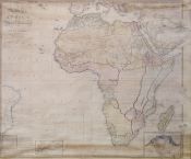
36. A new map of Africa including Arabia, the Mediterranean and part of the coast of South America compiled from the observations of the latest travellers, London, published the 1st. of Jany. 1800 by Rob. Wilkinson, Nº 58 Cornhill

Wilkinson, Robert (m. ca. 1825), cartógrafo - 1800
Biblioteca Nacional de España

37. A New Map of the Counties of Cumberland and Westmoreland, Divided into their respective Wards [Material cartográfico] : From the Best Survey & Intelligences Illustrated with Historical Extracts relative to Natural History Produce, Trade & Manufactures : Shewing also the Rectories & Vicarages with various other Improvements 1760

Wilkinson, Robert (m. ca. 1825) - 1760
Biblioteca Nacional de España

38. A new map of Ireland divides into provinces, countis [Material cartográfico]

Bennett, John (m. 1787) - 1777
Biblioteca Nacional de España

39. A New Map of the Kingdom of Poland [Material cartográfico] : with all its Divisions and the Dismember'd Provinces

Dunn, Samuel (m. 1794) - 1794
Biblioteca Nacional de España

40. A New Map of South America [Material cartográfico] : drawn from the latest Discoveries

Wilkinson, Robert (m. ca. 1825) - 1794